Key Facts
The Nockregion-Oberkärnten is located in the southernmost province of Austria (Carinthia), bordering the province of Salzburg (district of Tamsweg) and the province of Styria (district of Murau). The region includes 17 municipalities spread over three political districts. The total area is 1,324 km2, with a permanent settlement area comprising only about 15% of the area. In addition to Spittal an der Drau, the main settlement areas are the municipalities of Seeboden and Radenthein. The population of about 52.500 inhabitants has been continuously shrinking for the past years (-3.5% between 2011 and 2021 with considerable differences between the municipalities), a trend that, according to population forecasts, will not change.
The region is located in the Central Alps, the highest peak lies at 3.360 m (Hochalmspitze). The natural features range from hilly mountainous areas to high alpine mountains and lake landscapes. A specifically mountainous municipality is part of the national park “Hohe Tauern” and carries the touristic label of a “Mountaineering Village”. Furthermore, some municipalities are part of the Biosphere Reserve Salzburger Lungau and Kärntner Nockberge. According to the geographical and spatial conditions, the predominant land use is agriculture (mostly permanent grassland), forestry, mountain pasture management and tourism.
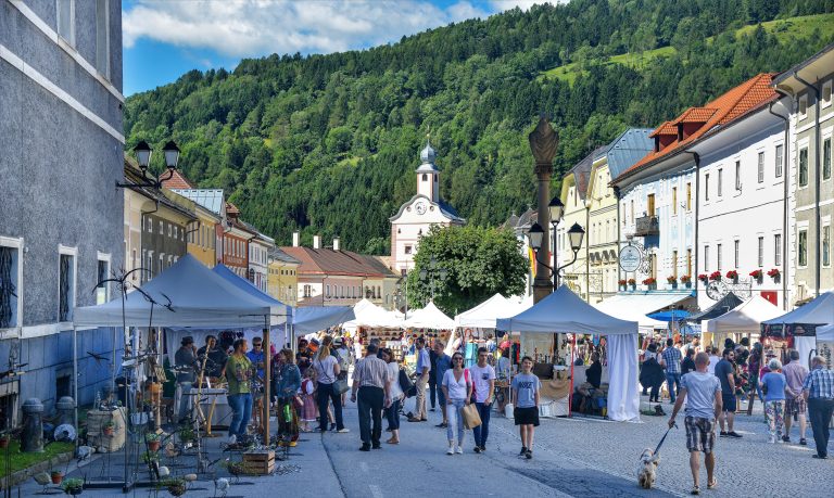
The lake “Millstätter See” is one of the four large lakes in Carinthia and a main touristic attraction. About 2 Mio overnight stays during the summer season illustrate the importance of tourism which offers besides the attractive location of the lake, also (recreational) sports activities in the mainly gentle, less steep mountains (compared to the adjacent rugged mountain range of the Hohe Tauern). Winter tourism is less pronounced but has still about 1 Mio overnight stays (with the exception of 2021 when Covid-19 lock downs restricted winter tourism development massively). Other significant sectors are agriculture and forestry, crafts, trade and industry, regional energy production, construction and the wood sector.
The region Nockregion-Oberkärnten is situated at an important European north-south connection (motorway A10) and at other supra-regional traffic routes, which provide a good connection of the central municipalities of the region with the Carinthian central region and the surrounding federal provinces, while remote municipalities are less accessible. The region faces major challenges for development, such as an unbalanced job structure, strong deficits in job supply, negative demographic development, in particular, out-migration, especially of young people and women, aging and high commuter rates.
With regard to governance the region is well developed. The regional agency “Spittal-Millstättersee-Lieser-Malta-Nockberge” is a main actor and steers continuity and strategic development of the region. Besides socio-economic development it also promotes activities and programmes focusing on climate change adaptation, such as a Climate Change Adaption Model Region named “Klar! Nockregion” and three “Climate and Energy Model Regions” (KEM). 16 municipalities of the region are also organized as a LEADER Local Action Group (LAG). Another decidedly environmental and regional development approach is pursued in the four municipalities consisting of the Carinthian part of the Biosphere Reserve “Salzburger Lungau und Kärntner Nockberge” and one municipality, which is part of the national park “Hohe Tauern”.


